3D Laser Scanning Opportunities
With advanced, highly accurate, non-invasive scanning technology and experienced operators, Neglia is proud to supply our clients with 3D Laser Scanning solutions. Our advanced laser scanning equipment can produce point cloud data at a rate of 2,000,000 points per second, effectively reducing site disruptions, return site visits, and overall project costs. This quickly captured data is used to create precise 2D plans, drawings, and 3D models of objects, environments, landscapes, infrastructure, utilities, and more.
3D Laser Scanning, also known as high-definition surveying or reality capture, documents the site conditions of a project’s life cycle: from planning and design stages to as-builts during and after construction and renovations, our state-of-the-art technology captures it all. 3D Laser Scanning is often the safest option as well. Field crews can stay out of busy roadways and off the rails, allowing them to document site conditions from a safe distance and location. This also reduces extra costs associated with lane closures, flagmen, foul time, etc.
Learn More About our 3D Laser Scanning Services
Boundary and Topographic Survey Support
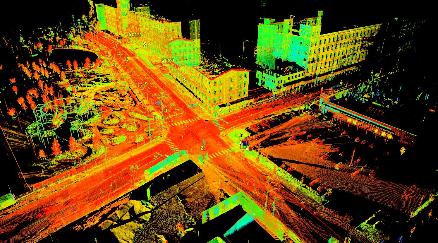
Many of our projects are located along main roads, highways, rail lines, and hard-to-access areas. Laser Scanning allows for documentation of these areas while keeping our crews out of harm’s way and speeding up the data acquisition process.
Construction As-Builts
Whether it’s for future stakeholders involved in a project or for ensuring construction is progressing as designed, 3D representations of a site can reduce costs and delays. Laser Scanning allows safe and accurate documentation of areas of any size with little disruption to the work in progress.
Right of Way and Roadway Surveys
Laser scanning ensures project requirements and deadlines are met, all while avoiding traffic disruptions and keeping crews safe whether on local streets or on multi-lane highways. Striping, grading, ADA requirements, overhead wires, bridge clearances. etc. are all within the point cloud data for CAD specialists to extract.
3D Models
Point cloud data can be used to create accurate 3D models for design, planning, and documenting existing conditions. Everything in the point cloud can be measured, modeled, or extracted. 3D models also allow designers and fabricators to be “on-site” without leaving the office.
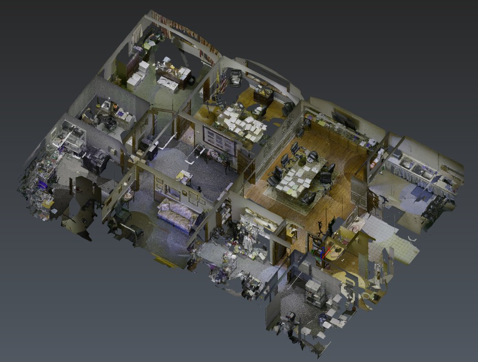
Floor Plans
We provide floor plans with various levels of detail, from simple wall outlines to including door swings, window measurements, bathroom and kitchen fixture configuration, and elevations on floors and ceilings. Point clouds can highlight rooms with unique configurations and provide details that are difficult to document with traditional techniques.
Existing Conditions
Architects, engineers, and trade designers all benefit from accurate and highly detailed point cloud data. Using this data as their background during the design process can provide information, details, and data to ensure project costs, rework, and construction conflicts are reduced or eliminated.
Mechanical Spaces
We can provide the raw point cloud or deliverables ranging from 2D surveys to 3D models of mechanical spaces, pump rooms, elevator machine rooms, or other spaces with limited access, large areas, or where hand measurements would be insufficient. Colorized point clouds can add greater realism with more detail.
Latest Projects
Leave Us A Message
Fill out the form below or give us a call.
"*" indicates required fields